08-23-2022

Hawai'i 3D Map Images

Founder & certified Hawai'i travel expert with 20+ years of experience in Hawai'i tourism.
This article may contain affiliate links. We earn a small commission at no extra cost to you. Mahalo!
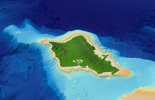
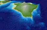
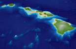
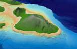
Hawai'i Maps in 3D, both above and beneath the ocean waves; it's not a sight you get to see very often. Being married to a Geography Major, I thought these Hawaiian Island 3D images were fascinating and simply had to share with our followers. Below are some of our favorite images from the good folks over at the Hawai'i SOEST Mapping website run by the University of Hawai'i at Manoa.
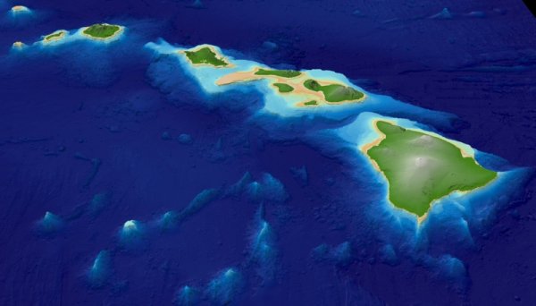
The images show not only the Hawaiian Islands in 3D as they exist above sea level, but also their topography visually beneath the ocean waves. Here you can see just how close to the surface some of the land is in various locations, especially around the islands of Maui, Moloka'i, and Lana'i (which used to be one large island called "Maui Nui"). The excellent view of the seafloor topography is quite interesting, showing that Pele has been at work in many areas around the Hawaiian Islands as well. You can also see the Hawaiian Islands newest addition that's slowly making its way to the surface, Loihi, just off the southeast coast of the Big Island of Hawai'i.

Published by: John C. Derrick
Founder & certified Hawai'i travel expert with 20+ years of experience in Hawai'i tourism.
Hawai'i 3D Map Images Photo Gallery


Affiliate Disclosure: We may earn commissions from some travel partners (like Amazon or Expedia) which helps us maintain this site. These links are at no extra cost to you and don't impact our honest & unbiased recommendations. Remove all the ads →
